
Pölling topographic map
Interactive map
Click on the map to display elevation.
About this map
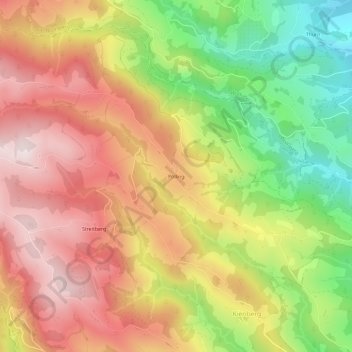
Name: Pölling topographic map, elevation, terrain.
Average elevation: 829 m
Minimum elevation: 488 m
Maximum elevation: 1,117 m
Other topographic maps
Click on a map to view its topography, its elevation and its terrain.
Schönweg - Sankt Andrä
Österreich > Kärnten > Bezirk Wolfsberg > Sankt Andrä
Schönweg - Sankt Andrä, Sankt Andrä, Bezirk Wolfsberg, Kärnten, 9433, Österreich
Average elevation: 565 m