Geolocate

Young topographic map

Click on the map to display elevation.

About this map

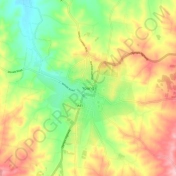
Name: Young topographic map, elevation, terrain.

Location: Young, Hilltops Council, New South Wales, Australia (-34.35035 148.25718 -34.27035 148.33718)

Average elevation: 473 m

Minimum elevation: 391 m

Maximum elevation: 567 m

New South Wales trails, hiking, mountain biking, running and outdoor activities

Gear up for your next adventure:

🎧Bluetooth Outdoor Earbuds - Listen to navigation cues or podcasts during long solo treks
🆘Personal Locator Beacons (PLB) - Satellite emergency beacons for life-saving help in areas with no mobile coverage
🧦Hiking Socks - Comfortable socks for long hikes
🕶️Polarized Sunglasses - UV protection sunglasses for outdoors
📖Australian Bush Survival Books - Local knowledge on finding water and surviving the outback

As an Amazon Associate, this site earns from qualifying purchases at no extra cost to you.