

Fuenlabrada topographic map
Click on the map to display elevation.
Fuenlabrada
The highest point in the municipality (721 metres above sea level) is located in a hill to the northwest of the city proper. The city proper's altitude gently decreases from the Northwest to the Southeast; the lowest areas in the municipality (slightly over 600 metres above sea level) are located in the East, past the A-42 near the border with Getafe.
About this map
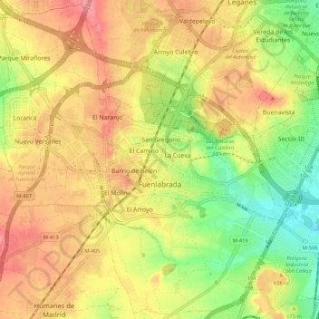
Name: Fuenlabrada topographic map, elevation, terrain.
Location: Fuenlabrada, Community of Madrid, Spain (40.24959 -3.84404 40.32774 -3.73930)
Average elevation: 665 m
Minimum elevation: 612 m
Maximum elevation: 710 m
Other topographic maps
Click on a map to view its topography, its elevation and its terrain.
Madrid
Spain > Community of Madrid > Área metropolitana de Madrid y Corredor del Henares > Madrid
Average elevation: 650 m