Braunlage topographic map
Click on the map to display elevation.
Braunlage
Braunlage is located on the Warme Bode, a headstream of the river Bode, close to the border with Elend in the state of Saxony-Anhalt. The municipal area stretches along the south-eastern rim of the Harz National Park from an elevation of 550 m (1,800 ft) up to 971 m (3,186 ft) at the summit of the Wurmberg. Other peaks in the vicinity include the Achtermannshöhe and the Hahnenklee Crags.
About this map
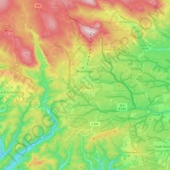
Name: Braunlage topographic map, elevation, terrain.
Location: Braunlage, Landkreis Goslar, Lower Saxony, 37444, Germany (51.65048 10.49041 51.78148 10.68401)
Average elevation: 618 m
Minimum elevation: 360 m
Maximum elevation: 966 m
Other topographic maps
Click on a map to view its topography, its elevation and its terrain.