Geolocate

Feorlig topographic map

Click on the map to display elevation.

About this map

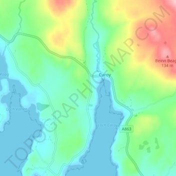
Name: Feorlig topographic map, elevation, terrain.

Location: Feorlig, Caroy, Highland, Scotland, IV55 8ZL, United Kingdom (57.38208 -6.51794 57.42208 -6.47794)

Average elevation: 38 m

Minimum elevation: -1 m

Maximum elevation: 139 m

Gear up for your next adventure:

🐍Australian Snake Bite Kits - Specific pressure immobilization bandages for Australian venomous snakes
📖Australian Bush Survival Books - Local knowledge on finding water and surviving the outback
🥤Hydration Packs - Hydration systems for hiking
🧺Fast-Dry Microfiber Towels - Large towels that pack down to the size of an orange
🧢Outdoor Sun Hats - Sun protection hats for hiking

As an Amazon Associate, this site earns from qualifying purchases at no extra cost to you.