Geolocate

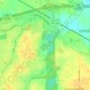
Hunters Point topographic map

Click on the map to display elevation.

About this map

Name: Hunters Point topographic map, elevation, terrain.

Location: Hunters Point, Montgomery, Montgomery County, Alabama, 36116, United States (32.28153 -86.25663 32.32153 -86.21663)

Average elevation: 66 m

Minimum elevation: 52 m

Maximum elevation: 81 m

Other topographic maps

Click on a map to view its topography, its elevation and its terrain.
Gear up for your next adventure:

🧴Sunscreen SPF - Sun protection for outdoor activities
⌚GPS Watches - GPS watches for outdoor sports
📕Hiking Guide Books - Guides for hiking trails
🧥Thermal Emergency Blankets - Compact Mylar blankets to prevent hypothermia if stranded overnight
🛌Sleeping Mats - Insulated mats for camping comfort

As an Amazon Associate, this site earns from qualifying purchases at no extra cost to you.