Geolocate

Concan topographic map

Click on the map to display elevation.

About this map
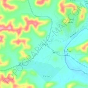
Name: Concan topographic map, elevation, terrain.

Location: Concan, Uvalde County, Texas, 78838, United States (29.48044 -99.74263 29.52044 -99.70263)

Average elevation: 419 m

Minimum elevation: 369 m

Maximum elevation: 530 m

Other topographic maps

Click on a map to view its topography, its elevation and its terrain.
Garner State Park

United States > Texas > Uvalde County > Concan

Average elevation: 456 m

Sabinal

United States > Texas > Uvalde County

Average elevation: 289 m

Garner State Park

United States > Texas > Uvalde County > Concan

Average elevation: 456 m

Gear up for your next adventure:

⌚GPS Watches - GPS watches for outdoor sports
🧥Packable Rain Jackets - Breathable waterproof layers for unpredictable mountain weather
🏃Compression Recovery Socks - Reduce leg fatigue after heavy days of elevation gain
🎽Hiking Clothing - Breathable clothing for hiking
🗺️Topographic Maps - Detailed maps for hiking and navigation

As an Amazon Associate, this site earns from qualifying purchases at no extra cost to you.