Geolocate

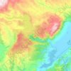
Kelso topographic map

Click on the map to display elevation.

About this map

Name: Kelso topographic map, elevation, terrain.

Location: Kelso, Clutha District, Otago, 9522, New Zealand (-45.91599 169.22015 -45.89599 169.24015)

Average elevation: 168 m

Minimum elevation: 137 m

Maximum elevation: 315 m

Other topographic maps

Click on a map to view its topography, its elevation and its terrain.
Waipori River

New Zealand > Otago > Clutha District

Average elevation: 330 m

Ōwaka River

New Zealand > Otago > Clutha District

Average elevation: 179 m

Tahakopa River

New Zealand > Otago > Clutha District

Average elevation: 244 m

Gear up for your next adventure:

🎒Dry Bags - Waterproof bags for outdoor gear
⌚GPS Watches - GPS watches for outdoor sports
🔋Solar Power Banks - Charge your phone and GPS using the sun while deep in the bush
🛠️Outdoor Repair Kits - Gear repair kits
📡Portable Emergency Radios - Stay informed about weather warnings and bushfire alerts

As an Amazon Associate, this site earns from qualifying purchases at no extra cost to you.