Geolocate

Amadeo topographic map

Click on the map to display elevation.

About this map

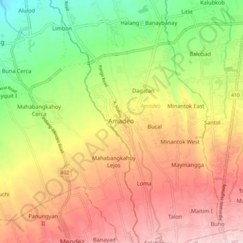
Name: Amadeo topographic map, elevation, terrain.

Location: Amadeo, Cavite, Calabarzon, 4119, Philippines (14.12957 120.88197 14.20957 120.96197)

Average elevation: 422 m

Minimum elevation: 260 m

Maximum elevation: 575 m

Gear up for your next adventure:

📚Map Reading & Navigation Guides - Master the art of interpreting topographic contours and symbols
🚗Car Camping Gear - Equipment for vehicle camping
🎧Bluetooth Outdoor Earbuds - Listen to navigation cues or podcasts during long solo treks
👟Lightweight Trail Runners - Agile footwear for fast movement over rugged Australian terrain
🗺️Topographic Maps - Detailed maps for hiking and navigation

As an Amazon Associate, this site earns from qualifying purchases at no extra cost to you.