
Thank you for supporting this site ❤️
Make a donation
Make a donation
Gear up for your next adventure:
As an Amazon Associate, this site earns from qualifying purchases at no extra cost to you.
Sakti topographic map
Click on the map to display elevation.
Thank you for supporting this site ❤️
Make a donation
Make a donation
Gear up for your next adventure:
As an Amazon Associate, this site earns from qualifying purchases at no extra cost to you.
About this map
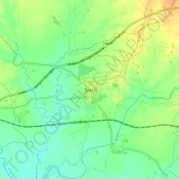
Name: Sakti topographic map, elevation, terrain.
Location: Sakti, Sakti Tahsil, Sakti, Chhattisgarh, 495689, India (21.98626 82.91983 22.06626 82.99983)
Average elevation: 237 m
Minimum elevation: 223 m
Maximum elevation: 256 m
Thank you for supporting this site ❤️
Make a donation
Make a donation
Gear up for your next adventure:
As an Amazon Associate, this site earns from qualifying purchases at no extra cost to you.