
Thank you for supporting this site ❤️
Make a donation
Make a donation
Gear up for your next adventure:
As an Amazon Associate, this site earns from qualifying purchases at no extra cost to you.
Mitua topographic map
Click on the map to display elevation.
Thank you for supporting this site ❤️
Make a donation
Make a donation
Gear up for your next adventure:
As an Amazon Associate, this site earns from qualifying purchases at no extra cost to you.
About this map
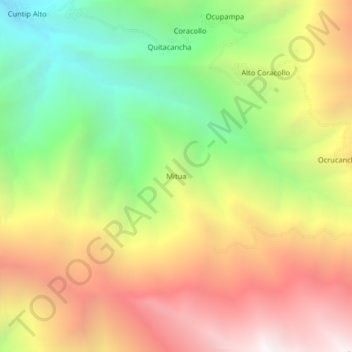
Name: Mitua topographic map, elevation, terrain.
Location: Mitua, Quillo, Province of Yungay, Ancash, Peru (-9.39216 -77.97101 -9.35216 -77.93101)
Average elevation: 3,331 m
Minimum elevation: 2,267 m
Maximum elevation: 4,449 m
Thank you for supporting this site ❤️
Make a donation
Make a donation
Gear up for your next adventure:
As an Amazon Associate, this site earns from qualifying purchases at no extra cost to you.