Make a donation
Gear up for your next adventure:
As an Amazon Associate, this site earns from qualifying purchases at no extra cost to you.
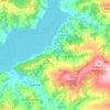
Grybów topographic map
Click on the map to display elevation.
Make a donation
Gear up for your next adventure:
As an Amazon Associate, this site earns from qualifying purchases at no extra cost to you.
Grybów
Grybów is a town in the Nowy Sącz County, in Lesser Poland Voivodeship of Poland, with 12,409 inhabitants (2005). It is located in the heartland of the Doły Jasielsko Sanockie (Doły Pits), and its average altitude is 370 metres above sea level, although there are some hills located within the confines of the city, Grybów has the steepest town square in medieval Europe.
Make a donation
Gear up for your next adventure:
As an Amazon Associate, this site earns from qualifying purchases at no extra cost to you.
About this map

Name: Grybów topographic map, elevation, terrain.
Location: Grybów, Nowy Sącz County, Lesser Poland Voivodeship, Poland (49.59407 20.90548 49.63580 21.00910)
Average elevation: 433 m
Minimum elevation: 304 m
Maximum elevation: 826 m
Make a donation
Gear up for your next adventure:
As an Amazon Associate, this site earns from qualifying purchases at no extra cost to you.
Other topographic maps
Click on a map to view its topography, its elevation and its terrain.

Koszarka
Poland > Lesser Poland Voivodeship > Nowy Sącz County > Gródek nad Dunajcem
Average elevation: 328 m