Geolocate

Hechingen topographic map

Click on the map to display elevation.

About this map
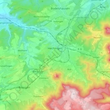
Name: Hechingen topographic map, elevation, terrain.

Location: Hechingen, Gemeindeverwaltungsverband Hechingen, Zollernalbkreis, Baden-Württemberg, 72379, Germany (48.30011 8.89075 48.39081 9.06222)

Average elevation: 586 m

Minimum elevation: 412 m

Maximum elevation: 958 m

Other topographic maps

Click on a map to view its topography, its elevation and its terrain.
Wessingen

Germany > Baden-Württemberg > Zollernalbkreis

Average elevation: 562 m

Wessingen

Germany > Baden-Württemberg > Zollernalbkreis

Average elevation: 562 m

Gear up for your next adventure:

🧊Insulated Stainless Steel Flasks - Keep water cold for 24 hours in the heat or coffee hot in the cold
🧴Sunscreen SPF - Sun protection for outdoor activities
🧼Biodegradable Outdoor Soap - Clean gear and yourself without harming the local ecosystem
🔋Rechargeable Batteries - Eco-friendly power for high-drain GPS units and flashlights
🔥Windproof Plasma Lighters - USB rechargeable lighters that work in high-altitude winds

As an Amazon Associate, this site earns from qualifying purchases at no extra cost to you.