
Thank you for supporting this site ❤️
Make a donation
Make a donation
Gear up for your next adventure:
As an Amazon Associate, this site earns from qualifying purchases at no extra cost to you.
Sullia topographic map
Click on the map to display elevation.
Thank you for supporting this site ❤️
Make a donation
Make a donation
Gear up for your next adventure:
As an Amazon Associate, this site earns from qualifying purchases at no extra cost to you.
About this map
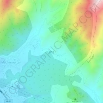
Name: Sullia topographic map, elevation, terrain.
Location: Sullia, Tinta, Province of Canchis, Cusco, Peru (-14.16714 -71.38542 -14.12714 -71.34542)
Average elevation: 3,693 m
Minimum elevation: 3,479 m
Maximum elevation: 4,328 m
Thank you for supporting this site ❤️
Make a donation
Make a donation
Gear up for your next adventure:
As an Amazon Associate, this site earns from qualifying purchases at no extra cost to you.