
Velpen topographic map
Interactive map
Click on the map to display elevation.
About this map
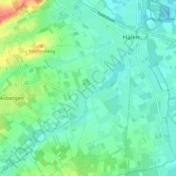
Name: Velpen topographic map, elevation, terrain.
Location: Velpen, Halen, Hasselt, Limburg, 3545, België (50.91627 5.07869 50.95627 5.11869)
Average elevation: 30 m
Minimum elevation: 17 m
Maximum elevation: 68 m
Other topographic maps
Click on a map to view its topography, its elevation and its terrain.
Loksbergen
België > Limburg > Hasselt > Halen
Loksbergen, Halen, Hasselt, Limburg, België
Average elevation: 42 m