Geolocate

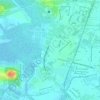
Salgado Filho topographic map

Click on the map to display elevation.

About this map

Name: Salgado Filho topographic map, elevation, terrain.

Location: Salgado Filho, Aracaju, Região Geográfica Imediata de Aracaju, Região Geográfica Intermediária de Aracaju, Sergipe, Região Nordeste, Brasil (-10.93388 -37.06094 -10.92515 -37.05163)

Average elevation: 6 m

Minimum elevation: 1 m

Maximum elevation: 17 m

Other topographic maps

Click on a map to view its topography, its elevation and its terrain.

Parque da Sementeira

Brasil > Sergipe > Aracaju

Average elevation: 4 m

Praça Camerino

Brasil > Sergipe > Aracaju

Average elevation: 6 m

Parque da Sementeira

Brasil > Sergipe > Aracaju

Average elevation: 4 m

Praça Santiago Dantas

Brasil > Sergipe > Aracaju

Average elevation: 8 m

Eldourado

Brasil > Sergipe > Aracaju

Average elevation: 9 m

Rio Poxim

Brasil > Sergipe > Aracaju

Average elevation: 9 m

Aquarius

Brasil > Sergipe > Aracaju

Average elevation: 7 m

Praia dos Coqueiros

Brasil > Sergipe > Aracaju

Average elevation: 6 m

Gear up for your next adventure:

🆘Personal Locator Beacons (PLB) - Satellite emergency beacons for life-saving help in areas with no mobile coverage
⛺Lightweight Tents - Compact tents for backpacking
🍳Camping Cookware - Cookware sets for outdoor meals
🔦LED Torches - LED torches for outdoor use
🧳Outdoor Travel Organizers - Gear organization accessories

As an Amazon Associate, this site earns from qualifying purchases at no extra cost to you.