Geolocate

Muscotah topographic map

Click on the map to display elevation.

About this map

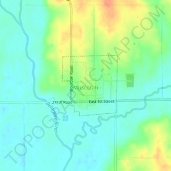
Name: Muscotah topographic map, elevation, terrain.

Location: Muscotah, Atchison County, Kansas, 66058, United States (39.54830 -95.52640 39.55785 -95.51514)

Average elevation: 304 m

Minimum elevation: 289 m

Maximum elevation: 332 m

Other topographic maps

Click on a map to view its topography, its elevation and its terrain.

Shannon

United States > Kansas > Atchison County

Average elevation: 330 m

Cummings

United States > Kansas > Atchison County

Average elevation: 316 m

Gear up for your next adventure:

🧺Waterproof Dry Sacks - Organize your pack and keep electronics safe from rain and river crossings
🧼Clip-on Hand Sanitizer - Maintain hygiene when water for washing is scarce
🧼Biodegradable Soap - Eco-friendly outdoor soap
🩹First Aid Kits - Emergency kits for hiking
🎒3L Hydration Reservoirs - Hands-free drinking to stay hydrated on steep contour climbs

As an Amazon Associate, this site earns from qualifying purchases at no extra cost to you.