
Verviers topographic map
Interactive map
Click on the map to display elevation.
About this map
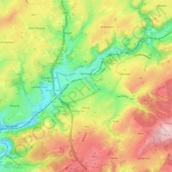
Name: Verviers topographic map, elevation, terrain.
Location: Verviers, Liegi, Wallonie, 4800, Belgio (50.54926 5.81305 50.62596 5.92553)
Average elevation: 262 m
Minimum elevation: 137 m
Maximum elevation: 396 m
Other topographic maps
Click on a map to view its topography, its elevation and its terrain.
Francorchamps
Belgio > Liegi > Verviers > Stavelot
Francorchamps, Stavelot, Verviers, Liegi, Wallonie, 4970, Belgio
Average elevation: 482 m