
Brandberg topographic map
Interactive map
Click on the map to display elevation.
About this map
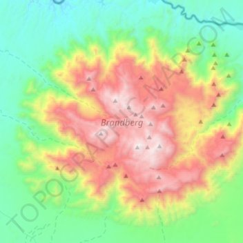
Name: Brandberg topographic map, elevation, terrain.
Location: Brandberg, Erongo Region, Namibia (-21.23564 14.41264 -21.00914 14.69200)
Average elevation: 1,126 m
Minimum elevation: 367 m
Maximum elevation: 2,561 m
Other topographic maps
Click on a map to view its topography, its elevation and its terrain.