
Vissenaken topographic map
Interactive map
Click on the map to display elevation.
About this map
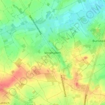
Name: Vissenaken topographic map, elevation, terrain.
Location: Vissenaken, Tienen, Vlaams-Brabant, Vlaanderen, 3300, België (50.81799 4.89703 50.85799 4.93703)
Average elevation: 58 m
Minimum elevation: 34 m
Maximum elevation: 88 m