
Morthemer topographic map
Interactive map
Click on the map to display elevation.
About this map
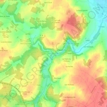
Name: Morthemer topographic map, elevation, terrain.
Average elevation: 107 m
Minimum elevation: 67 m
Maximum elevation: 140 m
Other topographic maps
Click on a map to view its topography, its elevation and its terrain.
Pinchaud
France > Nouvelle-Aquitaine > Vienne > Morthemer
Pinchaud, Morthemer, Valdivienne, Montmorillon, Vienne, Nouvelle-Aquitaine, France métropolitaine, 86300, France
Average elevation: 110 m