
Kaluyo topographic map
Interactive map
Click on the map to display elevation.
About this map
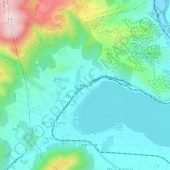
Name: Kaluyo topographic map, elevation, terrain.
Location: Kaluyo, Thajra, Arbieto, Esteban Arze, Cochabamba, Bolivia (-17.54711 -66.12926 -17.50711 -66.08926)
Average elevation: 2,779 m
Minimum elevation: 2,671 m
Maximum elevation: 3,119 m