Geolocate

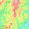
Alfonso Castañeda topographic map

Click on the map to display elevation.

About this map

Name: Alfonso Castañeda topographic map, elevation, terrain.

Location: Alfonso Castañeda, Nueva Vizcaya, Cagayan Valley, Philippines (15.75331 121.26356 15.83331 121.34356)

Average elevation: 405 m

Minimum elevation: 160 m

Maximum elevation: 961 m

Other topographic maps

Click on a map to view its topography, its elevation and its terrain.

Kasibu River

Philippines > Nueva Vizcaya > Kasibu

Average elevation: 866 m

Casecnan River

Philippines > Nueva Vizcaya > Pelaway

Average elevation: 963 m

Kayapa

Philippines > Nueva Vizcaya

Average elevation: 1,258 m

Gear up for your next adventure:

🧴Sunscreen SPF - Sun protection for outdoor activities
📕Hiking Guide Books - Guides for hiking trails
🍴Titanium Spork & Cutlery - Indestructible and feather-light eating utensils
🛌Sleeping Bags - Sleeping bags for outdoor camping
🦶Orthotic Hiking Insoles - Extra arch support for long-distance topographic treks

As an Amazon Associate, this site earns from qualifying purchases at no extra cost to you.