Geolocate

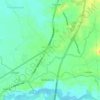
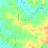
Tukod topographic map

Click on the map to display elevation.

About this map

Name: Tukod topographic map, elevation, terrain.

Location: Tukod, San Rafael, Bulacan, Central Luzon, 3008, Philippines (14.97035 121.03301 15.00819 121.05958)

Average elevation: 77 m

Minimum elevation: 39 m

Maximum elevation: 164 m

Other topographic maps

Click on a map to view its topography, its elevation and its terrain.
Diliman I

Philippines > Bulacan > San Rafael

Average elevation: 25 m

Purok 3

Philippines > Bulacan > San Rafael

Average elevation: 19 m

Tukod

Philippines > Bulacan > San Rafael

Average elevation: 79 m

Mabalas-balas

Philippines > Bulacan > San Rafael

Average elevation: 23 m

Lico

Philippines > Bulacan > San Rafael > Lico

Average elevation: 26 m

Dagat-dagatan

Philippines > Bulacan > San Rafael > Dagat-dagatan

Average elevation: 14 m

Pulong Bayabas

Philippines > Bulacan > San Rafael

Average elevation: 12 m

Maronquillo

Philippines > Bulacan > San Rafael

Average elevation: 39 m

Sapang Pahalang

Philippines > Bulacan > San Rafael

Average elevation: 72 m

Coral na Bato

Philippines > Bulacan > San Rafael

Average elevation: 42 m

San Agustin

Philippines > Bulacan > San Rafael

Average elevation: 17 m

Cruz na Daan

Philippines > Bulacan > San Rafael > Cruz na Daan

Average elevation: 19 m

Dagat-dagatan

Philippines > Bulacan > San Rafael

Average elevation: 14 m

Tukod

Philippines > Bulacan > San Rafael

Average elevation: 79 m

Gear up for your next adventure:

🧼Clip-on Hand Sanitizer - Maintain hygiene when water for washing is scarce
📦Crushproof Equipment Cases - Safe transport for sensitive surveying and mapping instruments
🖼️Scratch-off Australia Map - Track the regions and peaks you have explored geographically
☀️Portable Solar Chargers - High-efficiency panels to hang on your backpack while walking
🔪Camping Knives - Multi-purpose outdoor knives

As an Amazon Associate, this site earns from qualifying purchases at no extra cost to you.