Geolocate

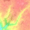
Milford topographic map

Click on the map to display elevation.

About this map

Name: Milford topographic map, elevation, terrain.

Location: Milford, Clermont County, Ohio, United States (39.15222 -84.30226 39.19191 -84.25081)

Average elevation: 187 m

Minimum elevation: 146 m

Maximum elevation: 265 m

Other topographic maps

Click on a map to view its topography, its elevation and its terrain.
Perintown

United States > Ohio > Clermont County

Average elevation: 199 m

Cedron

United States > Ohio > Clermont County

Average elevation: 228 m

The Highlands

United States > Ohio > Clermont County

Average elevation: 218 m

Amelia

United States > Ohio > Clermont County

Average elevation: 265 m

Sundale

United States > Ohio > Clermont County

Average elevation: 229 m

Concord

United States > Ohio > Clermont County

Average elevation: 253 m

The Highlands

United States > Ohio > Clermont County

Average elevation: 218 m

Hills

United States > Ohio > Clermont County

Average elevation: 243 m

Laurel

United States > Ohio > Clermont County

Average elevation: 252 m

The Highlands

United States > Ohio > Clermont County

Average elevation: 218 m

Saltair

United States > Ohio > Clermont County

Average elevation: 268 m

The Highlands

United States > Ohio > Clermont County

Average elevation: 218 m

Gear up for your next adventure:

🪢550 Survival Paracord - Versatile cordage for gear repair and emergency lashing
🔭Compact Hiking Binoculars - Lightweight optics for scouting routes or birdwatching
🚗Car Camping Gear - Equipment for vehicle camping
🩹Blister Prevention Tape - Apply to friction points before they become painful sores
📡Weather Radios - Emergency weather radios

As an Amazon Associate, this site earns from qualifying purchases at no extra cost to you.