Geolocate

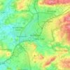
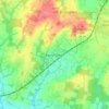
Rudgwick topographic map

Click on the map to display elevation.

About this map

Name: Rudgwick topographic map, elevation, terrain.

Location: Rudgwick, Bucks Green, Horsham, West Sussex, England, United Kingdom (51.04851 -0.49215 51.11651 -0.38466)

Average elevation: 50 m

Minimum elevation: 10 m

Maximum elevation: 96 m

Other topographic maps

Click on a map to view its topography, its elevation and its terrain.
Cootham

United Kingdom > England > West Sussex > Horsham > Storrington

Average elevation: 51 m

Horsham

United Kingdom > England > West Sussex > Horsham

Average elevation: 62 m

Wiggonholt

United Kingdom > England > West Sussex > Horsham > Wiggonholt

Average elevation: 17 m

Hardham

United Kingdom > England > West Sussex > Horsham > Coldwaltham

Average elevation: 13 m

Wineham

United Kingdom > England > West Sussex > Horsham

Average elevation: 18 m

Barns Green

United Kingdom > England > West Sussex > Horsham

Average elevation: 49 m

Horsham

United Kingdom > England > West Sussex > Horsham

Average elevation: 62 m

Hardham

United Kingdom > England > West Sussex > Horsham > Coldwaltham

Average elevation: 13 m

Horsham

United Kingdom > England > West Sussex > Horsham

Average elevation: 62 m

Gear up for your next adventure:

🧦Merino Wool Hiking Socks - Moisture-wicking socks to prevent blisters during long topographic surveys
🆘Personal Locator Beacons (PLB) - Satellite emergency beacons for life-saving help in areas with no mobile coverage
🌬️Windbreaker Jackets - Wind protection jackets
👣Snake & Scrub Gaiters - Protection against spinifex, mud, and snakes while walking off-track
📡Satellite Messengers - Emergency communication devices

As an Amazon Associate, this site earns from qualifying purchases at no extra cost to you.