
Lac Hamilton topographic map
Interactive map
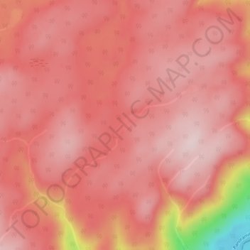
Click on the map to display elevation.
About this map
Name: Lac Hamilton topographic map, elevation, terrain.
Average elevation: 334 m
Minimum elevation: 82 m
Maximum elevation: 398 m
Other topographic maps
Click on a map to view its topography, its elevation and its terrain.
Réserve faunique de Matane
Canada > Québec > Rivière-Bonjour
Réserve faunique de Matane, Rivière-Bonjour, La Matanie, Bas-Saint-Laurent, Québec, Canada
Average elevation: 382 m
Auberge de montagne des Chic-Chocs
Canada > Québec > Rivière-Bonjour
Auberge de montagne des Chic-Chocs, Sentier de la chute Hélène, Rivière-Bonjour, La Matanie, Bas-Saint-Laurent, Québec, Canada
Average elevation: 565 m
Rivière-Bonjour
Canada > Québec > Rivière-Bonjour
Rivière-Bonjour, La Matanie, Bas-Saint-Laurent, Québec, Canada
Average elevation: 337 m
Lac Solitaire
Canada > Québec > Rivière-Bonjour
Lac Solitaire, Le Noroît, Rivière-Bonjour, La Matanie, Bas-Saint-Laurent, Québec, Canada
Average elevation: 791 m
Mont Fortin
Canada > Québec > Rivière-Bonjour
Mont Fortin, Rivière-Bonjour, La Matanie, Bas-Saint-Laurent, Québec, Canada
Average elevation: 801 m