Geolocate

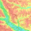
Hewlett topographic map

Click on the map to display elevation.

About this map

Name: Hewlett topographic map, elevation, terrain.

Location: Hewlett, Hanover County, Virginia, 23015, United States (37.90236 -77.59637 37.94236 -77.55637)

Average elevation: 75 m

Minimum elevation: 42 m

Maximum elevation: 92 m

Other topographic maps

Click on a map to view its topography, its elevation and its terrain.

Ashland

United States > Virginia > Hanover County

Average elevation: 66 m

Ashland

United States > Virginia > Hanover County

Average elevation: 66 m

Gear up for your next adventure:

🚴Bike GPS - GPS devices for cycling
📡Portable Emergency Radios - Stay informed about weather warnings and bushfire alerts
🎽Hiking Clothing - Breathable clothing for hiking
🔦LED Torches - LED torches for outdoor use
🕶️Polarized Sunglasses - UV protection sunglasses for outdoors

As an Amazon Associate, this site earns from qualifying purchases at no extra cost to you.