Geolocate

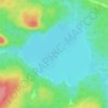
Ryan Lake topographic map

Click on the map to display elevation.

About this map

Name: Ryan Lake topographic map, elevation, terrain.

Location: Ryan Lake, Elliot Lake, Algoma District, Northeastern Ontario, Ontario, Canada (46.34373 -82.56815 46.34375 -82.56785)

Average elevation: 302 m

Minimum elevation: 266 m

Maximum elevation: 338 m

Other topographic maps

Click on a map to view its topography, its elevation and its terrain.
Gullbeak Lake

Canada > Ontario > Algoma District > Elliot Lake

Average elevation: 329 m

Gear up for your next adventure:

🏕️Camping Gear - Essential camping equipment
🚗Car Camping Gear - Equipment for vehicle camping
🥶Thermal Beanies - Warm hats for cold hikes
🚴Cycling Backpacks - Backpacks for cyclists
🏃Compression Recovery Socks - Reduce leg fatigue after heavy days of elevation gain

As an Amazon Associate, this site earns from qualifying purchases at no extra cost to you.