
Dry Falls topographic map
Interactive map
Click on the map to display elevation.
About this map
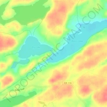
Name: Dry Falls topographic map, elevation, terrain.
Average elevation: 442 m
Minimum elevation: 409 m
Maximum elevation: 474 m
Other topographic maps
Click on a map to view its topography, its elevation and its terrain.
Duluth
Estados Unidos da América > Minnesota > Saint Louis County
Duluth, Saint Louis County, Minnesota, Estados Unidos da América
Average elevation: 286 m