Geolocate

Branson topographic map

Click on the map to display elevation.

About this map
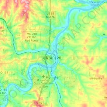
Name: Branson topographic map, elevation, terrain.

Location: Branson, Taney County, Missouri, United States (36.59433 -93.31472 36.70091 -93.21135)

Average elevation: 275 m

Minimum elevation: 210 m

Maximum elevation: 395 m

Other topographic maps

Click on a map to view its topography, its elevation and its terrain.
Ridgedale

United States > Missouri > Taney County

Average elevation: 387 m

Table Rock

United States > Missouri > Taney County > Branson

Average elevation: 278 m

McClurg

United States > Missouri > Taney County

Average elevation: 347 m

Rueter

United States > Missouri > Taney County

Average elevation: 345 m

Mincy

United States > Missouri > Taney County

Average elevation: 278 m

Gear up for your next adventure:

☕Outdoor Coffee Makers - Enjoy quality coffee at the summit of your favorite peak
🎒40L Day Hiking Backpacks - Comfortable packs with hydration support for long days exploring topographic peaks
🐍Snake Gaiters - Protection against snake bites
🪢Paracord - Multi-purpose survival cord
🔦Powerful LED Headlamps - Hands-free lighting for night navigation and setting up camp after dark

As an Amazon Associate, this site earns from qualifying purchases at no extra cost to you.