
Тункинский район topographic map
Interactive map
Click on the map to display elevation.
About this map
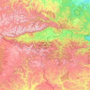
Name: Тункинский район topographic map, elevation, terrain.
Average elevation: 1,544 m
Minimum elevation: 425 m
Maximum elevation: 3,063 m
Other topographic maps
Click on a map to view its topography, its elevation and its terrain.
Окинский район
Окинский район, Bouriatie, District fédéral extrême-oriental, Russie
Average elevation: 1,651 m