
Mafate topographic map
Interactive map
Click on the map to display elevation.
About this map
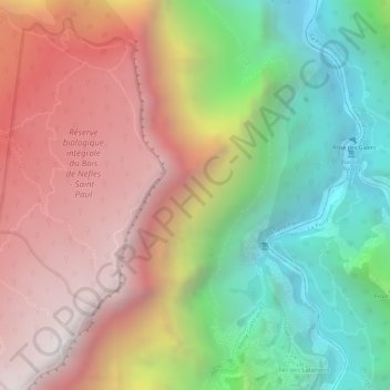
Name: Mafate topographic map, elevation, terrain.
Location: Mafate, Saint-Paul, La Réunion, France (-21.03482 55.38217 -21.01482 55.40217)
Average elevation: 1,062 m
Minimum elevation: 288 m
Maximum elevation: 1,783 m
Other topographic maps
Click on a map to view its topography, its elevation and its terrain.
La Saline les Bains
France > La Réunion > Saint-Paul > La Saline les Bains
La Saline les Bains, Saint-Paul, La Réunion, 97434, France
Average elevation: 52 m