Geolocate

Jenipapo topographic map

Click on the map to display elevation.

About this map
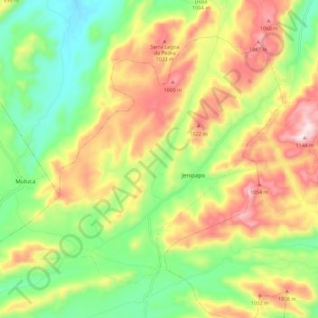
Name: Jenipapo topographic map, elevation, terrain.

Location: Jenipapo, Sanharó, Região Geográfica Imediata de Belo Jardim-Pesqueira, Região Geográfica Intermediária de Caruaru, Pernambuco, Região Nordeste, Brasil (-8.31178 -36.59182 -8.23060 -36.48593)

Average elevation: 831 m

Minimum elevation: 586 m

Maximum elevation: 1,146 m

Other topographic maps

Click on a map to view its topography, its elevation and its terrain.

Praça do Redondo

Brasil > Pernambuco > Sanharó

Average elevation: 668 m

Gear up for your next adventure:

🐍Australian Snake Bite Kits - Specific pressure immobilization bandages for Australian venomous snakes
🎽Base Layers - Thermal base layers
📖Australian Bush Survival Books - Local knowledge on finding water and surviving the outback
📚Map Reading & Navigation Guides - Master the art of interpreting topographic contours and symbols
🥾Hiking Shoes - Lightweight hiking shoes for day hikes

As an Amazon Associate, this site earns from qualifying purchases at no extra cost to you.