
Rurdorf topographic map
Interactive map
Click on the map to display elevation.
About this map
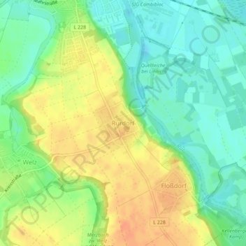
Name: Rurdorf topographic map, elevation, terrain.
Location: Rurdorf, Linnich, Kreis Düren, Nordrhein-Westfalen, Deutschland (50.96172 6.27123 50.96794 6.28024)
Average elevation: 78 m
Minimum elevation: 59 m
Maximum elevation: 99 m