
Bampton topographic map
Interactive map
Click on the map to display elevation.
About this map
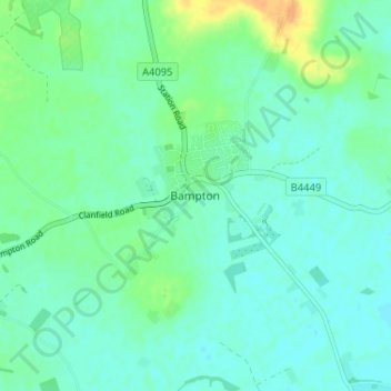
Name: Bampton topographic map, elevation, terrain.
Average elevation: 71 m
Minimum elevation: 63 m
Maximum elevation: 93 m
Other topographic maps
Click on a map to view its topography, its elevation and its terrain.
Bampton
United Kingdom > England > Bampton
Bampton, Cumbria, North West England, England, CA10 2RS, United Kingdom
Average elevation: 246 m
Bampton
United Kingdom > England > Bampton
Bampton, Devon, South West England, England, EX16 9ND, United Kingdom
Average elevation: 167 m