Geolocate

Talakag topographic map

Click on the map to display elevation.

About this map

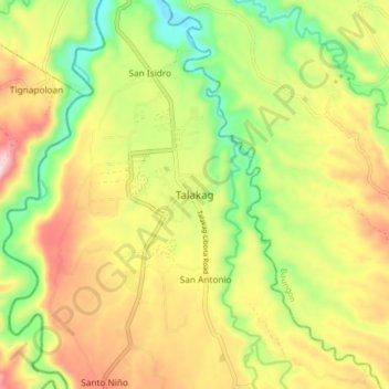
Name: Talakag topographic map, elevation, terrain.

Location: Talakag, Bukidnon, Northern Mindanao, 6*+21, Philippines (8.19143 124.56429 8.27143 124.64429)

Average elevation: 396 m

Minimum elevation: 177 m

Maximum elevation: 646 m

Other topographic maps

Click on a map to view its topography, its elevation and its terrain.

Gear up for your next adventure:

👄SPF Lip Balm - Prevent sun and wind-burnt lips on mountain ridges
🪢550 Survival Paracord - Versatile cordage for gear repair and emergency lashing
🔪Multitools - Compact tools for outdoor use
🌬️Windbreaker Jackets - Wind protection jackets
🏫Topographic World Globes - 3D physical relief globes to understand global geography

As an Amazon Associate, this site earns from qualifying purchases at no extra cost to you.