
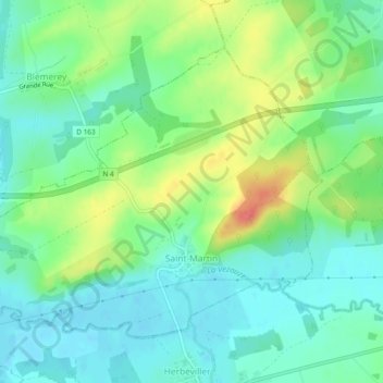
Saint-Martin topographic map
Interactive map
Click on the map to display elevation.
About this map
Name: Saint-Martin topographic map, elevation, terrain.
Average elevation: 262 m
Minimum elevation: 241 m
Maximum elevation: 306 m
Other topographic maps
Click on a map to view its topography, its elevation and its terrain.
Seichamps
França > Grande Leste > Meurthe-et-Moselle
Seichamps, Nancy, Meurthe-et-Moselle, Grande Leste, França metropolitana, 54280, França
Average elevation: 245 m
Landres
França > Grande Leste > Meurthe-et-Moselle
Landres, Briey, Meurthe-et-Moselle, Grande Leste, França metropolitana, 54970, França
Average elevation: 310 m
Nancy
França > Grande Leste > Meurthe-et-Moselle
Nancy, Meurthe-et-Moselle, Grande Leste, França metropolitana, França
Average elevation: 230 m