
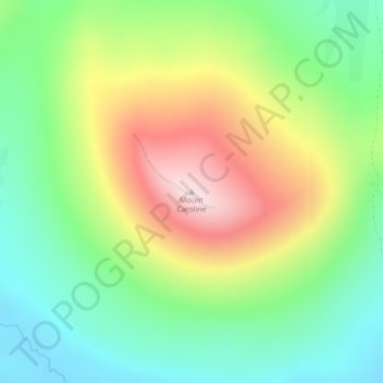
Mount Caroline topographic map
Interactive map
Click on the map to display elevation.
About this map
Name: Mount Caroline topographic map, elevation, terrain.
Location: Mount Caroline, Islas Malvinas, Falkland Islands (-51.51149 -59.53951 -51.51139 -59.53941)
Average elevation: 193 m
Minimum elevation: 32 m
Maximum elevation: 439 m
Other topographic maps
Click on a map to view its topography, its elevation and its terrain.
Halliday's Garden
Halliday's Garden, West Point, Falkland Islands
Average elevation: 69 m
Shallow Bay
Falkland Islands > Shallow Bay
Shallow Bay, Islas Malvinas, Falkland Islands
Average elevation: 40 m
Mount Usborne
Mount Usborne, Islas Malvinas, Falkland Islands
Average elevation: 459 m