
Garzón topographic map
Interactive map
Click on the map to display elevation.
About this map
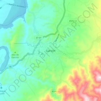
Name: Garzón topographic map, elevation, terrain.
Location: Garzón, Huila, 414020, Colombia (2.15601 -75.66748 2.23601 -75.58748)
Average elevation: 913 m
Minimum elevation: 686 m
Maximum elevation: 1,491 m
Other topographic maps
Click on a map to view its topography, its elevation and its terrain.