
King's Lynn and West Norfolk topographic map
Interactive map
Click on the map to display elevation.
About this map
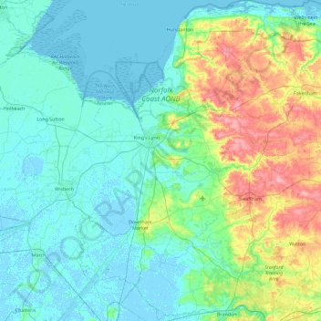
Name: King's Lynn and West Norfolk topographic map, elevation, terrain.
Location: King's Lynn and West Norfolk, Norfolk, England, United Kingdom (52.43644 0.15362 52.98980 0.82155)
Average elevation: 20 m
Minimum elevation: -4 m
Maximum elevation: 100 m
Other topographic maps
Click on a map to view its topography, its elevation and its terrain.
Walton Highway
United Kingdom > England > Norfolk > King's Lynn and West Norfolk
Average elevation: 3 m
Walpole St Andrew
United Kingdom > England > Norfolk > King's Lynn and West Norfolk
Average elevation: 3 m
Poringland Wood
United Kingdom > England > Norfolk > South Norfolk > Framingham Earl
Average elevation: 50 m