Geolocate

Anaheim topographic map

Click on the map to display elevation.

About this map
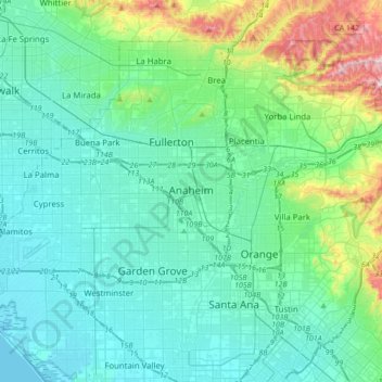
Name: Anaheim topographic map, elevation, terrain.

Location: Anaheim, Orange County, California, United States (33.78892 -118.01736 33.87906 -117.67397)

Average elevation: 89 m

Minimum elevation: -3 m

Maximum elevation: 513 m

Gear up for your next adventure:

🛰️Handheld GPS Units - Rugged GPS devices for tracking coordinates and elevation in the Australian bush
🚗Car Camping Gear - Equipment for vehicle camping
🔌Fast Charging Adapters - Quickly top up all your gear before heading back into the field
🧣Merino Neck Gaiters - Versatile headwear for warmth, sun protection, or dust filtering
🧰Survival Kits - Essential survival gear

As an Amazon Associate, this site earns from qualifying purchases at no extra cost to you.