
Kowary topographic map
Interactive map
Click on the map to display elevation.
About this map
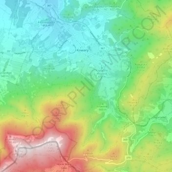
Name: Kowary topographic map, elevation, terrain.
Location: Kowary, powiat karkonoski, Basse-Silésie, 58-530, Pologne (50.74272 15.79170 50.81472 15.89383)
Average elevation: 698 m
Minimum elevation: 409 m
Maximum elevation: 1,270 m