Geolocate

Keyser Valley topographic map

Click on the map to display elevation.

About this map
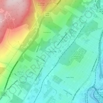
Name: Keyser Valley topographic map, elevation, terrain.

Location: Keyser Valley, Scranton, Lackawanna County, Pennsylvania, 18504, United States (41.40563 -75.71602 41.44563 -75.67602)

Average elevation: 328 m

Minimum elevation: 208 m

Maximum elevation: 606 m

Other topographic maps

Click on a map to view its topography, its elevation and its terrain.
Gear up for your next adventure:

🔥Ferrocerium Rod Fire Starters - Reliable fire lighting in wet or windy conditions without matches
📦Crushproof Equipment Cases - Safe transport for sensitive surveying and mapping instruments
🧼Biodegradable Outdoor Soap - Clean gear and yourself without harming the local ecosystem
🧭Military Style Lensatic Compass - Durable sighting compasses for advanced land navigation and surveying
🖼️Scratch-off Australia Map - Track the regions and peaks you have explored geographically

As an Amazon Associate, this site earns from qualifying purchases at no extra cost to you.