Geolocate

Titsey topographic map

Click on the map to display elevation.

About this map
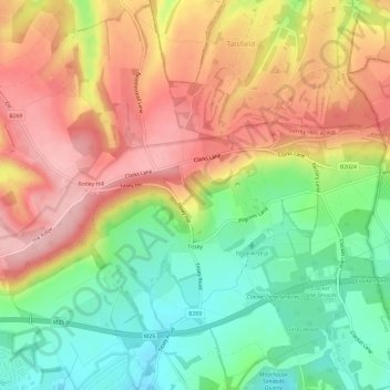
Name: Titsey topographic map, elevation, terrain.

Location: Titsey, Limpsfield, Tandridge, Surrey, England, United Kingdom (51.26238 -0.01728 51.29960 0.04088)

Average elevation: 185 m

Minimum elevation: 100 m

Maximum elevation: 271 m

Gear up for your next adventure:

🔥Windproof Plasma Lighters - USB rechargeable lighters that work in high-altitude winds
💡Collapsible Camping Lanterns - Illuminate your base camp or tent for map studying at night
🧴SPF 50+ Bulk Sunscreen - Maximum protection for long-term outdoor exposure
🎽Base Layers - Thermal base layers
🩹Blister Prevention Tape - Apply to friction points before they become painful sores

As an Amazon Associate, this site earns from qualifying purchases at no extra cost to you.