
Thank you for supporting this site ❤️
Make a donation
Make a donation
Gear up for your next adventure:
As an Amazon Associate, this site earns from qualifying purchases at no extra cost to you.
Whittlesea topographic map
Click on the map to display elevation.
Thank you for supporting this site ❤️
Make a donation
Make a donation
Gear up for your next adventure:
As an Amazon Associate, this site earns from qualifying purchases at no extra cost to you.
About this map
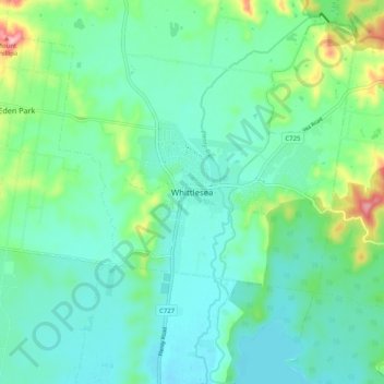
Name: Whittlesea topographic map, elevation, terrain.
Location: Whittlesea, City of Whittlesea, Victoria, 3757, Australia (-37.55213 145.07773 -37.47213 145.15773)
Average elevation: 216 m
Minimum elevation: 177 m
Maximum elevation: 352 m
Victoria trails, hiking, mountain biking, running and outdoor activities
Thank you for supporting this site ❤️
Make a donation
Make a donation
Gear up for your next adventure:
As an Amazon Associate, this site earns from qualifying purchases at no extra cost to you.