
Beihai topographic map
Interactive map
Click on the map to display elevation.
About this map
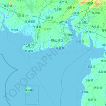
Name: Beihai topographic map, elevation, terrain.
Location: Beihai, Guangxi, China (20.88442 108.84383 21.92143 109.78449)
Average elevation: 16 m
Minimum elevation: -2 m
Maximum elevation: 619 m
Other topographic maps
Click on a map to view its topography, its elevation and its terrain.
Yangshuo County
Yangshuo County, Guilin, Guangxi, China
Average elevation: 319 m
Pingnan County
China > Guangxi > Guigang > Chini
Pingnan County, Chini, Guigang, Guangxi, China
Average elevation: 36 m