
Mengha topographic map
Interactive map
Click on the map to display elevation.
About this map
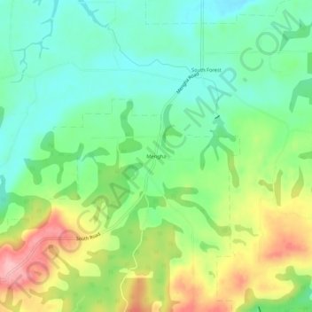
Name: Mengha topographic map, elevation, terrain.
Location: Mengha, Tasmania, Australia (-40.91462 145.22037 -40.87462 145.26037)
Average elevation: 84 m
Minimum elevation: 29 m
Maximum elevation: 180 m
Tasmania trails, hiking, mountain biking, running and outdoor activities