Geolocate

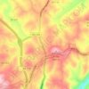
Fancy Gap topographic map

Click on the map to display elevation.

About this map

Name: Fancy Gap topographic map, elevation, terrain.

Location: Fancy Gap, Carroll County, Virginia, 24328, United States (36.64652 -80.71187 36.68652 -80.67187)

Average elevation: 868 m

Minimum elevation: 651 m

Maximum elevation: 977 m

Other topographic maps

Click on a map to view its topography, its elevation and its terrain.
Hillsville

United States > Virginia > Carroll County

Average elevation: 769 m

Cana

United States > Virginia > Carroll County > Cana

Average elevation: 422 m

Fancy Gap

United States > Virginia > Carroll County

Average elevation: 865 m

Fancy Gap

United States > Virginia > Carroll County

Average elevation: 865 m

Hillsville

United States > Virginia > Carroll County

Average elevation: 769 m

Gear up for your next adventure:

🎽Base Layers - Thermal base layers
🏃Compression Recovery Socks - Reduce leg fatigue after heavy days of elevation gain
🎒40L Day Hiking Backpacks - Comfortable packs with hydration support for long days exploring topographic peaks
🎒Daypacks - Compact backpacks for short hikes
🩹Wilderness First Aid Kits - Comprehensive medical kits tailored for hiking and remote exploration

As an Amazon Associate, this site earns from qualifying purchases at no extra cost to you.