
Baruta topographic map
Interactive map
Click on the map to display elevation.
About this map
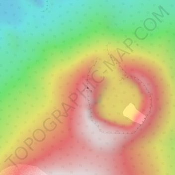
Name: Baruta topographic map, elevation, terrain.
Average elevation: 2,750 m
Minimum elevation: 2,281 m
Maximum elevation: 3,131 m
Other topographic maps
Click on a map to view its topography, its elevation and its terrain.
Lava Lake of Mount Nyiragongo
Democratic Republic of the Congo > North Kivu > Nyiragongo
Lava Lake of Mount Nyiragongo, Bukumu, Nyiragongo, North Kivu, Democratic Republic of the Congo
Average elevation: 3,084 m
Nyiragongo
Democratic Republic of the Congo > North Kivu > Nyiragongo
Nyiragongo, North Kivu, Democratic Republic of the Congo
Average elevation: 1,970 m